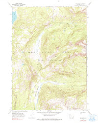
1965 Map of Joy Peak
USGS Topo · Published 1990About this map
Joy Peak stands at the center of this remote high-altitude survey, which documents the pristine wilderness of the Teton National Forest in the mid-1960s. The landscape is defined by its complex hydrology, where the North Fork Buffalo Fork and Soda Fork carve through deep valleys, buffered by high-mountain grazing areas like North Fork Meadows and Soda Fork Meadows. These drainages served as critical corridors for early travel, evidenced by the established Two Ocean Pass Trail and North Buffalo Trail that thread through the peaks.
Find a feature on this map
22 named features on this map. Tap any name to fly to it.
Don’t see what you’re looking for? This feature index may not catch every label — zoom into the map to look around manually.
Map Details
Editions of this 1965 Joy Peak Map
2 editions found
Other maps of this area

1885 · Lake
USGS Topo · 1:125,000

1895 · Lake
USGS Topo · 1:125,000

1896 · Lake
USGS Topo · 1:125,000

1901 · Lake
USGS Topo · 1:125,000

1902 · Mt Leidy
USGS Topo · 1:125,000

1906 · Lake
USGS Topo · 1:125,000

1911 · Lake
USGS Topo · 1:125,000

1955 · Ashton
USGS Topo · 1:250,000

1955 · Driggs
USGS Topo · 1:250,000

1958 · Driggs
USGS Topo · 1:250,000