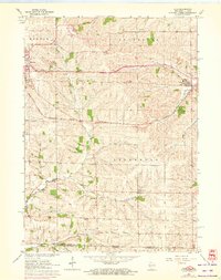
1962 Map of Juda
USGS Topo · Published 1972About this map
Agricultural life in Green County is centered around the Chicago Milwaukee St Paul and Pacific railroad, which cuts through the rolling topography to connect the village of Juda with the city of Monroe. This survey, updated with 1971 aerial observations, reveals a landscape defined by small rural hubs such as Twin Grove and East Clarno, where country schoolhouses like Twin Grove Sch and Pleasant Grove Sch served the surrounding farming families.
Find a feature on this map
29 named features on this map. Tap any name to fly to it.
Don’t see what you’re looking for? This feature index may not catch every label — zoom into the map to look around manually.
Map Details
Editions of this 1962 Juda Map
3 editions found
Other maps of this area

1893 · Brodhead
USGS Topo · 1:62,500

1920 · Monroe
USGS Topo · 1:62,500

1922 · Monroe
USGS Topo · 1:62,500

1932 · Pecatonica
USGS Topo · 1:62,500

1936 · Pecatonica
USGS Topo · 1:62,500

1939 · Freeport
USGS Topo · 1:48,000

1944 · Freeport
USGS Topo · 1:62,500

1954 · Rockford
USGS Topo · 1:250,000

1955 · Rockford
USGS Topo · 1:250,000

1958 · Rockford
USGS Topo · 1:250,000