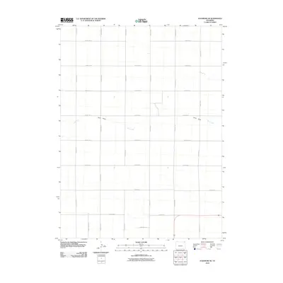
2010 Map of Julesburg SE
USGS Topo · Published 2010About this map
Sand Creek and the intermittent waters of Sand Draw define the drainage patterns of this high plains landscape in the northeast corner of Colorado. The map reveals a highly structured agricultural grid, where a network of section-line roads such as County Rd-31 and County Rd-18 partition the terrain into expansive tracts. This layout reflects the enduring influence of the Public Land Survey System on the regional geography, showing how transportation and land use are dictated by precise cardinal alignments. While the map is dominated by these open agricultural spaces, the meandering path of Sand Creek provides the primary natural interruption to the geometric regularity of the county road system, illustrating the seasonal water courses essential to this arid environment.
Find a feature on this map
18 named features on this map. Tap any name to fly to it.
Don’t see what you’re looking for? This feature index may not catch every label — zoom into the map to look around manually.
Map Details
Editions of this 2010 Julesburg SE Map
This is the sole edition of this map. No revisions or reprints were ever made.
Other maps of this area

1952 · Julesburg SW
USGS Topo · 1:24,000

1952 · Julesburg SE
USGS Topo · 1:24,000

1953 · Ovid
USGS Topo · 1:24,000

1953 · Julesburg
USGS Topo · 1:24,000

1954 · Sterling
USGS Topo · 1:250,000

1958 · Sterling
USGS Topo · 1:250,000

1962 · Venango SW
USGS Topo · 1:24,000

1962 · Holyoke NE
USGS Topo · 1:24,000

1962 · Amherst
USGS Topo · 1:24,000
1962 · Venango NW
USGS Topo · 1:24,000