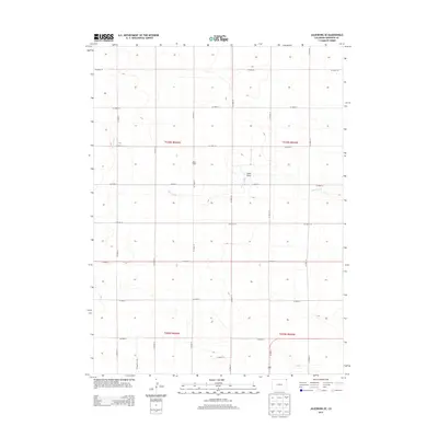
2013 Map of Julesburg SE
USGS Topo · Published 2013About this map
Miller School stands as a focal point in this portion of Sedgwick County, reflecting the early settlement patterns of the Colorado plains. The map reveals a strictly organized grid of county roads, such as Co Road 18 and Co Road 35, which delineate the expansive agricultural sections. This rigid human geography is interrupted only by the natural, winding paths of Sand Creek and the distinctive indentation of Sand Draw. These drainage features provide essential relief to the high plains terrain, often serving as critical markers for local land ownership and movement through the region. The inclusion of Us 385 N in the southern corner highlights the corridor connecting these rural townships to broader regional hubs, providing a clear picture of the area's infrastructure in the early 21st century.
Find a feature on this map
24 named features on this map. Tap any name to fly to it.
Don’t see what you’re looking for? This feature index may not catch every label — zoom into the map to look around manually.
Map Details
Editions of this 2013 Julesburg SE Map
This is the sole edition of this map. No revisions or reprints were ever made.
Other maps of this area

1952 · Julesburg SW
USGS Topo · 1:24,000

1952 · Julesburg SE
USGS Topo · 1:24,000

1953 · Ovid
USGS Topo · 1:24,000

1953 · Julesburg
USGS Topo · 1:24,000

1954 · Sterling
USGS Topo · 1:250,000

1958 · Sterling
USGS Topo · 1:250,000

1962 · Venango SW
USGS Topo · 1:24,000

1962 · Holyoke NE
USGS Topo · 1:24,000

1962 · Amherst
USGS Topo · 1:24,000
1962 · Venango NW
USGS Topo · 1:24,000