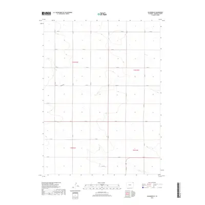
2019 Map of Julesburg SE
USGS Topo · Published 2019About this map
Sand Draw and Sand Cr define the hydrological character of this Sedgwick County landscape, showing the intermittent drainage patterns typical of the high plains. The terrain is organized by a precise grid of county roads, with north-south routes like Co Rd 33 and Co Rd 39 intersecting east-west paths such as Co Rd 12 and Co Rd 8. This network reflects the Public Land Survey System structure of townships t10n r45w and t10n r44w, where the landscape is meticulously divided into sections. The sparse distribution of named water features against the dense road grid highlights the transition of this territory from open range into a highly managed agricultural or industrial grid, where even the smallest drainages like Sand Cr are significant landmarks in an otherwise uniform topography.
Find a feature on this map
21 named features on this map. Tap any name to fly to it.
Don’t see what you’re looking for? This feature index may not catch every label — zoom into the map to look around manually.
Map Details
Editions of this 2019 Julesburg SE Map
This is the sole edition of this map. No revisions or reprints were ever made.
Other maps of this area

1952 · Julesburg SW
USGS Topo · 1:24,000

1952 · Julesburg SE
USGS Topo · 1:24,000

1953 · Ovid
USGS Topo · 1:24,000

1953 · Julesburg
USGS Topo · 1:24,000

1954 · Sterling
USGS Topo · 1:250,000

1958 · Sterling
USGS Topo · 1:250,000

1962 · Venango SW
USGS Topo · 1:24,000

1962 · Holyoke NE
USGS Topo · 1:24,000

1962 · Amherst
USGS Topo · 1:24,000
1962 · Venango NW
USGS Topo · 1:24,000