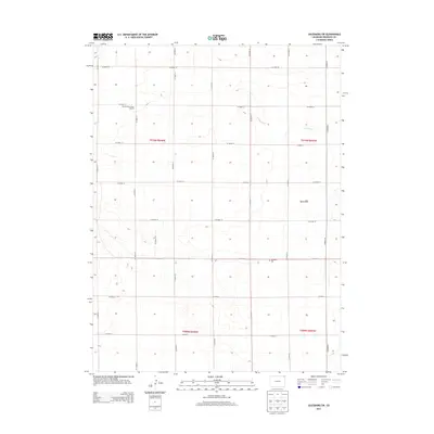
2013 Map of Julesburg SW
USGS Topo · Published 2013About this map
Agricultural patterns and ephemeral drainages define this portion of Sedgwick County, Colorado. The landscape is structured by a rigorous section-line road network, including Co Road 18, Co Road 14, and Co Road 29, which facilitate the region's dryland farming operations. A key indicator of the area's rural history is the Prairie View School (Aban'd), located along Co Road 16, reflecting the consolidation of early 20th-century school districts.
Find a feature on this map
25 named features on this map. Tap any name to fly to it.
Don’t see what you’re looking for? This feature index may not catch every label — zoom into the map to look around manually.
Map Details
Editions of this 2013 Julesburg SW Map
This is the sole edition of this map. No revisions or reprints were ever made.
Other maps of this area

1952 · Julesburg SW
USGS Topo · 1:24,000

1952 · Julesburg SE
USGS Topo · 1:24,000

1952 · Marks Butte
USGS Topo · 1:24,000

1953 · Ovid
USGS Topo · 1:24,000

1953 · Julesburg
USGS Topo · 1:24,000

1953 · Sedgwick
USGS Topo · 1:24,000

1954 · Sterling
USGS Topo · 1:250,000

1958 · Sterling
USGS Topo · 1:250,000

1962 · Holyoke NE
USGS Topo · 1:24,000

1962 · Haxtun East
USGS Topo · 1:24,000