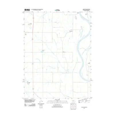
2011 Map of Julian
USGS Topo · Published 2011About this map
Julian and the rural stretches of Nemaha County are defined by the winding course of the Missouri River as it passes Schemmel Island and the historical Platte Purchase territory. The landscape is a network of drainage basins, with Camp Creek, Rock Creek, and Fourmile Creek carving through the agricultural uplands. Evidence of early water management is visible at the Buffalo City Reservoir and its associated Buffalo City Dam, while the community centers at Arbor and Minersville represent long-standing rural settlements in the region. Transportation and infrastructure are anchored by the Nebraska City Municipal Airport and the smaller Gress Farms Airport, reflecting the area's modern connectivity. Local history is preserved at the Camp Creek Cemetery, a central landmark for genealogists, while the Julian Post Office serves as the primary hub for the small community in the southwestern portion of the quadrangle.
Find a feature on this map
32 named features on this map. Tap any name to fly to it.
Don’t see what you’re looking for? This feature index may not catch every label — zoom into the map to look around manually.
Map Details
Editions of this 2011 Julian Map
This is the sole edition of this map. No revisions or reprints were ever made.
Other maps of this area

1907 · Nebraska City
USGS Topo · 1:62,500

1915 · Nemaha
USGS Topo · 1:62,500

1915 · Howe
USGS Topo · 1:62,500

1939 · Hamburg
USGS Topo · 1:62,500

1939 · Nemaha
USGS Topo · 1:62,500

1941 · Hamburg
USGS Topo · 1:62,500

1949 · Nemaha
USGS Topo · 1:62,500

1955 · Nebraska City
USGS Topo · 1:250,000

1957 · Nebraska City
USGS Topo · 1:250,000

1958 · Nebraska City
USGS Topo · 1:250,000