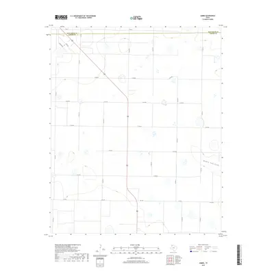
2019 Map of Jumbo
USGS Topo · Published 2019About this map
Middle Tule Draw cuts across the southeastern portion of this landscape, representing a significant topographical drainage feature in this corner of the Texas Panhandle. Located along the boundary of Deaf Smith Co and Castro Co, the area is defined by a rigorous grid of section-line roads such as Co RD 605 and Co RD 513. This high plains region exhibits numerous localized depressions, often associated with playa lakes, which appear as scattered topographic contours throughout the quadrangle. The agricultural infrastructure is evident in the transition between rural routes like Busby Rd and Coronado Rd and the more established state-maintained FM 2943 and FM 2397, reflecting a landscape dedicated to large-scale ranching or dryland farming at the time of this 2019 survey.
Find a feature on this map
22 named features on this map. Tap any name to fly to it.
Don’t see what you’re looking for? This feature index may not catch every label — zoom into the map to look around manually.
Map Details
Editions of this 2019 Jumbo Map
This is the sole edition of this map. No revisions or reprints were ever made.
Other maps of this area

1954 · Clovis
USGS Topo · 1:250,000

1958 · Clovis
USGS Topo · 1:250,000

1961 · Buffalo Lake
USGS Topo · 1:62,500

1965 · Dimmitt
USGS Topo · 1:24,000

1965 · Dimmitt SW
USGS Topo · 1:24,000

1965 · Nazareth SW
USGS Topo · 1:24,000

1966 · Jumbo
USGS Topo · 1:24,000

1966 · Nazareth NW
USGS Topo · 1:24,000

1966 · Easter
USGS Topo · 1:24,000

1970 · Hereford
USGS Topo · 1:24,000