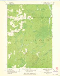
1970 Map of Jump River Fire Tower SW
USGS Topo · Published 1972About this map
The Chequamegon National Forest dominates this northern Wisconsin landscape, where the town boundaries of Jump River, Westboro, Cleveland, and Grover meet. Published by the Geological Survey from aerial photographs taken in 1965, the map reveals a region defined by its water and timber heritage. The Jump River and Yellow River wind through the terrain, marked by numerous rapids that characterize the rocky riverbeds of Taylor County.
Find a feature on this map
15 named features on this map. Tap any name to fly to it.
Don’t see what you’re looking for? This feature index may not catch every label — zoom into the map to look around manually.
Map Details
Editions of this 1970 Jump River Fire Tower SW Map
2 editions found
Other maps of this area

1945 · Black River
USGS Topo · 1:48,000

1947 · Sheldon
USGS Topo · 1:48,000

1949 · Sheldon
USGS Topo · 1:48,000

1949 · Jump River Fire Tower
USGS Topo · 1:48,000

1951 · Lublin
USGS Topo · 1:48,000

1951 · Gilman
USGS Topo · 1:62,500

1953 · Rice Lake
USGS Topo · 1:250,000

1959 · Rice Lake
USGS Topo · 1:250,000

1969 · Perkinstown
USGS Topo · 1:24,000
1969 · Lublin NW
USGS Topo · 1:24,000