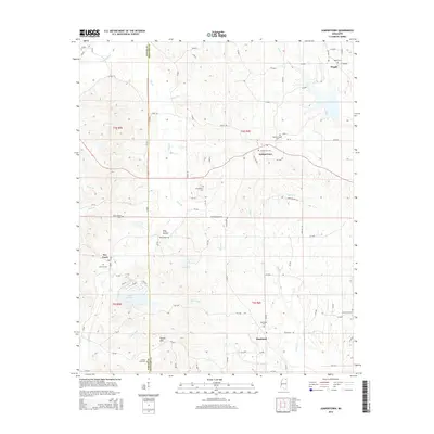
2015 Map of Jumpertown
USGS Topo · Published 2015About this map
Jumpertown and the surrounding borderlands of Prentiss and Tippah counties appear here as a landscape defined by small-scale farming and quiet rural communities. The map tracks the shift from the higher elevations of the Tippah Hills in the southwest toward the drainage basins of the Hatchie River and Wolf Cr. For genealogists and local historians, the sheet is particularly valuable for its documentation of family and community nodes, such as Pisgah, Blackland, and Dry Creek. Numerous burial grounds are clearly marked, including Jumpertown Cem and Morton Chapel Cem, which anchor the local history of these unincorporated areas. The inclusion of Lake Mohawk and Cox Lake provides a look at the local water resources that have shaped settlement patterns and property lines for generations in this part of North Mississippi.
Find a feature on this map
94 named features on this map. Tap any name to fly to it.
Don’t see what you’re looking for? This feature index may not catch every label — zoom into the map to look around manually.
Map Details
Editions of this 2015 Jumpertown Map
This is the sole edition of this map. No revisions or reprints were ever made.
Other maps of this area

1921 · Booneville
USGS Topo · 1:48,000

1922 · Booneville
USGS Topo · 1:62,500

1950 · Corinth
USGS Topo · 1:62,500

1951 · Walnut
USGS Topo · 1:62,500

1955 · Ripley
USGS Topo · 1:62,500

1956 · Tupelo
USGS Topo · 1:250,000

1958 · Tupelo
USGS Topo · 1:250,000

1972 · Jumpertown
USGS Topo · 1:24,000
1973 · Wheeler
USGS Topo · 1:24,000
1973 · Baldwyn
USGS Topo · 1:24,000