Loading...
Loading map...1947 Map of Juncos SE
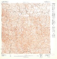
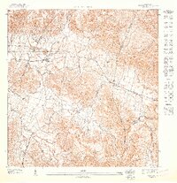
USGS Topo · Published 1947This historical map portrays the area of Juncos SE in 1947, primarily covering Las Piedras Municipio as well as portions of Humacao Municipio, Yabucoa Municipio, Juncos Municipio, and San Lorenzo Municipio. Featuring a scale of 1:10000, this map provides a highly detailed snapshot of the terrain, roads, buildings, counties, and historical landmarks in the Juncos SE region at the time. Published in 1947, it is the sole known edition of this map.
Map Details
Date Portrayed1947
Date Published1947
PublisherU.S. Geological Survey
Map TypeTopographic
Scale1:10000
Physical Dimensions30.55 x 31.7 inches
Editions of this 1947 Juncos SE Map
This is the sole edition of this map. No revisions or reprints were ever made.
Historical Maps of Sector Mingo Torres Through Time
Featured Locations
- Las Piedras
- Cinco Cuerdas, Las Piedras
- Estancias del Prado, Las Piedras
- Sector Mingo Torres, Las Piedras
- Sector Puesta del Sol, Las Piedras
Source Details
SourceU.S. Geological Survey
CopyrightPublic Domain