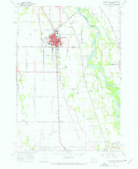
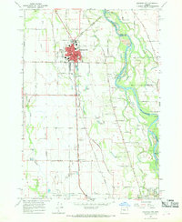
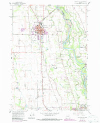
1967 Map of Junction City
USGS Topo · Published 1968About this map
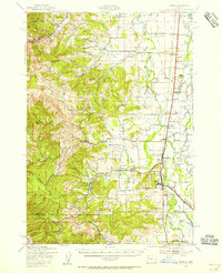
The Oregon Southern Pacific and Oregon Electric railroads converge at Junction City, anchoring a landscape defined by the serpentine Willamette River and its intricate waterway network. In the late 1960s, the area shows a balance of agricultural lands and growing municipal infrastructure, with local education centralized at Laurel Sch, Central Sch, and the nearby Riverview Sch. Genealogists will find interest in the Milliorn Cem and family-named roads like Bailey Lane and Pitney Lane. The southern reaches are dominated by the Mahlon Sweet Airport and recreational sites such as the Shadow Hills Country Club. From the gravel pits near Amazon Creek to the industrial waste ponds in the north, the map documents the mid-century transition of this valley floor as it supported both heavy transport and local farming.
Find a feature on this map
75 named features on this map. Tap any name to fly to it.
Don’t see what you’re looking for? This feature index may not catch every label — zoom into the map to look around manually.
Map Details
Editions of this 1967 Junction City Map
3 editions found
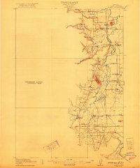
Other maps of this area

1909 · Harrisburg
USGS Topo · 1:31,680

1909 · Rowland
USGS Topo · 1:31,680

1909 · Elmira
USGS Topo · 1:62,500

1910 · Eugene
USGS Topo · 1:62,500

1911 · Monroe
USGS Topo · 1:31,680

1912 · Halsey
USGS Topo · 1:62,500

1922 · Monroe
USGS Topo · 1:62,500
1922 · Elmira
USGS Topo · 1:62,500
1939 · Monroe
USGS Topo · 1:62,500

1940 · Eugene
USGS Topo · 1:62,500