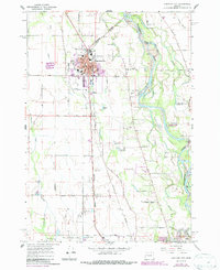
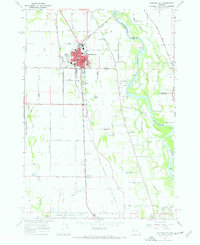
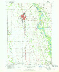
1967 Map of Junction City
USGS Topo · Published 1987About this map
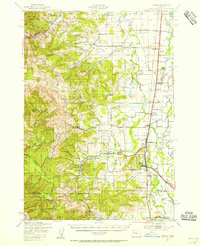
Junction City serves as a critical rail hub in the Southern Willamette Valley, where the Burlington Northern and Southern Pacific lines converge. This mid-century survey illustrates the town's grid expanding eastward toward the Willamette River, anchored by civic landmarks like Laurel Sch and the Jr High Sch. The surrounding landscape is a complex network of agriculture and water management, featuring named sloughs and the distinct Marshall Island formed by the Marshall Island River and the main channel.
Find a feature on this map
80 named features on this map. Tap any name to fly to it.
Don’t see what you’re looking for? This feature index may not catch every label — zoom into the map to look around manually.
Map Details
Editions of this 1967 Junction City Map
3 editions found
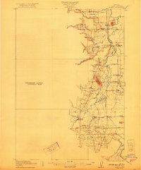
Other maps of this area

1909 · Harrisburg
USGS Topo · 1:31,680

1909 · Rowland
USGS Topo · 1:31,680

1909 · Elmira
USGS Topo · 1:62,500

1910 · Eugene
USGS Topo · 1:62,500

1911 · Monroe
USGS Topo · 1:31,680

1912 · Halsey
USGS Topo · 1:62,500

1922 · Monroe
USGS Topo · 1:62,500
1922 · Elmira
USGS Topo · 1:62,500
1939 · Monroe
USGS Topo · 1:62,500

1940 · Eugene
USGS Topo · 1:62,500