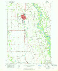
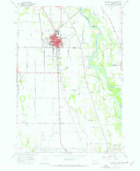
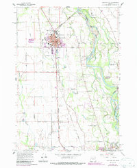
1967 Map of Junction City
USGS Topo · Published 1969About this map
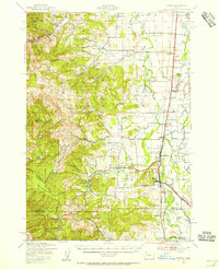
Junction City dominates the northern reaches of this survey, established as a major transportation hub where the Oregon Electric Railway and Southern Pacific lines converge. The surrounding landscape in the late 1960s reflects a balance of agriculture and infrastructure, with the southern portion featuring the Mahlon Sweet Airport and the manicured grounds of the Shadow Hills Country Club. Along the eastern border, the Willamette River meanders past Marshall Island, showing the river's original channels and sloughs before modern development altered the floodplain.
Find a feature on this map
72 named features on this map. Tap any name to fly to it.
Don’t see what you’re looking for? This feature index may not catch every label — zoom into the map to look around manually.
Map Details
Editions of this 1967 Junction City Map
3 editions found
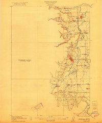
Other maps of this area

1909 · Harrisburg
USGS Topo · 1:31,680

1909 · Rowland
USGS Topo · 1:31,680

1909 · Elmira
USGS Topo · 1:62,500

1910 · Eugene
USGS Topo · 1:62,500

1911 · Monroe
USGS Topo · 1:31,680

1912 · Halsey
USGS Topo · 1:62,500

1922 · Monroe
USGS Topo · 1:62,500
1922 · Elmira
USGS Topo · 1:62,500
1939 · Monroe
USGS Topo · 1:62,500

1940 · Eugene
USGS Topo · 1:62,500