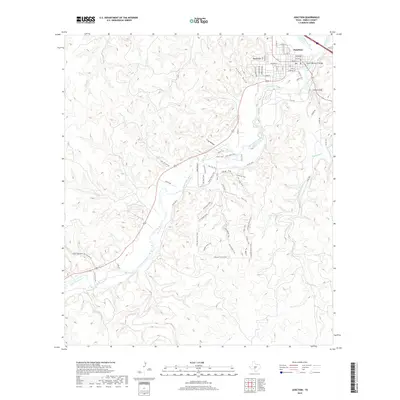
2019 Map of Junction
USGS Topo · Published 2019About this map
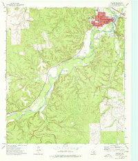
Junction sits at the significant confluence of the N Llano River and the South Llano River, forming the main stem of the Llano River. This 2019 survey captures the town's established grid, centered on Main St and College St, extending toward the State Highway 27 Bridge. The geography is defined by a series of drainages and high points, most notably Round Top overlooking the northern approach and the prominent bluff of Lovers Leap to the east. South of the city, the landscape transitions into a network of recreational paths including the River Trail, Buck Lake Trail, and Overlook Trail. The map details the intricate drainage system of the Edwards Plateau, tracing seasonal watercourses like Kountz Draw, Potter Cr, and the extensive Dry Cedar Cr as they cut through the limestone terrain toward the river basin.
Find a feature on this map
67 named features on this map. Tap any name to fly to it.
Don’t see what you’re looking for? This feature index may not catch every label — zoom into the map to look around manually.
Map Details
Editions of this 2019 Junction Map
This is the sole edition of this map. No revisions or reprints were ever made.
Other maps of this area

1926 · Segovia 2-c
USGS Topo · 1:48,000

1932 · Junction
USGS Topo · 1:62,500

1954 · Llano
USGS Topo · 1:250,000

1955 · Llano
USGS Topo · 1:250,000

1956 · Llano
USGS Topo · 1:250,000

1970 · Elm Slough
USGS Topo · 1:24,000
1970 · Stark Creek
USGS Topo · 1:24,000
1970 · Big Draw
USGS Topo · 1:24,000
1974 · Telegraph
USGS Topo · 1:24,000
1974 · Junction
USGS Topo · 1:24,000