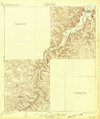
1932 Map of Junction
USGS Topo · Published 1932About this map
Junction and the surrounding Hill Country landscape are centered at the confluence of the North Fk and the South Llano River, where the Llano R begins its eastward course. This 1930s survey, conducted by S.T. Penick and W.B. Brewer, documents a transition in Texas transportation as State Highway No 27 follows the river valleys through the limestone terrain. While the town site is well-defined, large portions of the western and southeastern map are marked as a preliminary edition unsurveyed area, reflecting the remote nature of the divide at the time. Local life is anchored by small rural centers such as Telegraph and educational landmarks like Evergreen Sch and Paint Rock Sch. Water sources are critical to the region's geography, noted by prominent features such as Seven Hundred Springs and Paint Rock Sp, alongside the high bluff of Lovers Leap overlooking the river bends.
Find a feature on this map
18 named features on this map. Tap any name to fly to it.
Don’t see what you’re looking for? This feature index may not catch every label — zoom into the map to look around manually.
Map Details
Editions of this 1932 Junction Map
2 editions found
Other maps of this area

1893 · Rock Springs
USGS Topo · 1:125,000

1893 · Fort McKavett
USGS Topo · 1:125,000

1926 · Segovia 2-c
USGS Topo · 1:48,000

1932 · Junction
USGS Topo · 1:62,500

1954 · Llano
USGS Topo · 1:250,000

1954 · Sonora
USGS Topo · 1:250,000

1955 · Llano
USGS Topo · 1:250,000

1956 · Llano
USGS Topo · 1:250,000

1958 · Sonora
USGS Topo · 1:250,000

1962 · Hill Ranch
USGS Topo · 1:24,000