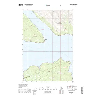
2017 Map of Juneau A-1 NW
USGS Topo · Published 2017About this map
Douglas Island and the coastal reaches of the Tongass National Forest dominate this maritime landscape near Juneau. The map details the steep, timbered slopes rising directly from the Gastineau Channel and the open waters of the Gulf of Alaska. Navigational landmarks like Tantallon Point and Point Salisbury mark the entrance to these protected waterways, where the terrain is punctuated by drainage features such as Goldstein Gulch and Grindstone Falls.
Find a feature on this map
28 named features on this map. Tap any name to fly to it.
Don’t see what you’re looking for? This feature index may not catch every label — zoom into the map to look around manually.
Map Details
Editions of this 2017 Juneau A-1 NW Map
This is the sole edition of this map. No revisions or reprints were ever made.
Other maps of this area

1947 · Juneau B-2
USGS Topo · 1:63,360

1948 · Juneau B-1
USGS Topo · 1:63,360

1949 · Juneau B-2
USGS Topo · 1:62,500

1951 · Juneau
USGS Topo · 1:250,000

1951 · Juneau A-2
USGS Topo · 1:63,360

1951 · Juneau A-1
USGS Topo · 1:63,360

1952 · Juneau B-1
USGS Topo · 1:63,360

1954 · Juneau A-1
USGS Topo · 1:63,360

1962 · Juneau B-2
USGS Topo · 1:63,360

1962 · Juneau
USGS Topo · 1:250,000