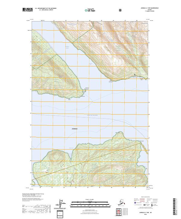
2024 Map of Juneau A-1 NW
USGS Topo · Published 2024About this map
Gastineau Channel separates the mainland from Douglas Island in this coastal Alaskan landscape, where the waters of the Gulf of Alaska meet steep glacial terrain. The map details a transition from the southern reaches of Juneau toward the protected wilds of the Admiralty Island National Monument and the Kootznoowoo Wilderness. Significant cultural and geographic landmarks include the Kuteha Indian Burial Grounds situated near Cherokee Flats, providing a rare point of named heritage in an otherwise natural expanse.
Find a feature on this map
33 named features on this map. Tap any name to fly to it.
Don’t see what you’re looking for? This feature index may not catch every label — zoom into the map to look around manually.
Map Details
Editions of this 2024 Juneau A-1 NW Map
This is the sole edition of this map. No revisions or reprints were ever made.
Other maps of this area

1947 · Juneau B-2
USGS Topo · 1:63,360

1948 · Juneau B-1
USGS Topo · 1:63,360

1949 · Juneau B-2
USGS Topo · 1:62,500

1951 · Juneau
USGS Topo · 1:250,000

1951 · Juneau A-2
USGS Topo · 1:63,360

1951 · Juneau A-1
USGS Topo · 1:63,360

1952 · Juneau B-1
USGS Topo · 1:63,360

1954 · Juneau A-1
USGS Topo · 1:63,360

1962 · Juneau B-2
USGS Topo · 1:63,360

1962 · Juneau
USGS Topo · 1:250,000