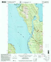
1997 Map of Juneau A-3
USGS Topo · Published 2000About this map
Mansfield Peninsula dominates this maritime landscape, where the waters of the Lynn Canal and Chatham Strait meet. This survey, revised in the late 1990s, documents a region defined by industrial extraction and federal conservation. To the north, Funter Bay serves as a focal point for local activity, surrounded by Funter Bay State Marine Park and the high peaks of Mount Robert Barron and Snowy Mountain. Evidence of the area's mineral history is visible at the Admiralty Mine and the more modern industrial footprint of the Waste Rock Site near Greens Creek. Navigational markers like the Lighthouse at Point Augusta and the beacon at Point Marsden highlight the critical role of the Alaska Marine Highway in connecting these isolated shorelines. The map also delineates the extensive boundaries of the Kootznoowoo Wilderness and Admiralty Island National Monument, preserving the character of Admiralty Island.
Find a feature on this map
43 named features on this map. Tap any name to fly to it.
Don’t see what you’re looking for? This feature index may not catch every label — zoom into the map to look around manually.
Map Details
Editions of this 1997 Juneau A-3 Map
This is the sole edition of this map. No revisions or reprints were ever made.
Other maps of this area

1947 · Juneau B-3
USGS Topo · 1:63,360

1947 · Juneau B-2
USGS Topo · 1:63,360

1948 · Juneau B-4
USGS Topo · 1:63,360

1948 · Juneau A-3
USGS Topo · 1:63,360

1948 · Juneau A-4
USGS Topo · 1:63,360

1948 · Sitka D-3
USGS Topo · 1:63,360

1948 · Sitka D-2
USGS Topo · 1:63,360

1948 · Sitka D-4
USGS Topo · 1:63,360

1949 · Juneau B-3
USGS Topo · 1:62,500

1949 · Juneau B-2
USGS Topo · 1:62,500