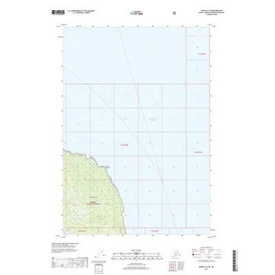
2017 Map of Juneau A-3 SW
USGS Topo · Published 2017About this map
Chichagof Island dominates the southwestern corner of this survey, where the dense coastal woodlands of the Tongass National Forest meet the maritime crossroads of Southeast Alaska. This maritime landscape is defined by the convergence of major waterways, including Chatham Strait and Icy Strait, which wrap around the prominent geographic marker of Point Augusta. The map provides a high-resolution look at the shoreline topography and bathymetry where the island's interior reaches the northern extent of the Gulf of Alaska. Navigators and maritime historians can trace the precise contours of this rugged coastline at a moment when the wilderness of the Tongass remained largely untouched by major development.
Find a feature on this map
11 named features on this map. Tap any name to fly to it.
Don’t see what you’re looking for? This feature index may not catch every label — zoom into the map to look around manually.
Map Details
Editions of this 2017 Juneau A-3 SW Map
This is the sole edition of this map. No revisions or reprints were ever made.
Other maps of this area

1948 · Juneau A-3
USGS Topo · 1:63,360

1948 · Juneau A-4
USGS Topo · 1:63,360

1948 · Sitka D-3
USGS Topo · 1:63,360

1948 · Sitka D-4
USGS Topo · 1:63,360

1950 · Juneau A-3
USGS Topo · 1:63,360

1951 · Juneau
USGS Topo · 1:250,000

1951 · Sitka
USGS Topo · 1:250,000

1951 · Sitka D-3
USGS Topo · 1:63,360

1952 · Sitka
USGS Topo · 1:250,000

1955 · Sitka D-4
USGS Topo · 1:63,360