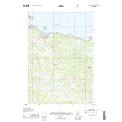
2017 Map of Juneau A-4 SW
USGS Topo · Published 2017About this map
The maritime environment of the Alexander Archipelago dominates this landscape, where the northern coast of Chichagof Island meets the open waters of Icy Strait. Situated within the Tongass National Forest, the terrain is defined by extreme relief, rising from the shoreline into high ridgelines and peaks such as Elephant Mtn and Hippo Back. The intricate drainage patterns of Spasski Cr and its tributaries carve through the timbered slopes, illustrating the complex hydrology of this part of the Alaskan Panhandle. While largely an undeveloped wilderness area, the map details the specific geographic elevations and nautical boundaries that define this coastal stretch of the Hoonah-Angoon Census Area.
Find a feature on this map
1 named feature on this map. Tap any name to fly to it.
Don’t see what you’re looking for? This feature index may not catch every label — zoom into the map to look around manually.
Map Details
Editions of this 2017 Juneau A-4 SW Map
This is the sole edition of this map. No revisions or reprints were ever made.
Other maps of this area

1948 · Juneau A-4
USGS Topo · 1:63,360

1948 · Sitka D-5
USGS Topo · 1:63,360

1948 · Sitka D-4
USGS Topo · 1:63,360

1951 · Juneau
USGS Topo · 1:250,000

1951 · Juneau A-5
USGS Topo · 1:63,360

1951 · Sitka
USGS Topo · 1:250,000

1951 · Sitka D-5
USGS Topo · 1:63,360

1952 · Sitka
USGS Topo · 1:250,000

1955 · Sitka D-4
USGS Topo · 1:63,360

1962 · Juneau
USGS Topo · 1:250,000