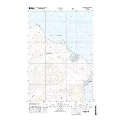
2015 Map of Juneau A-5 NW
USGS Topo · Published 2015About this map
Chichagof Island and the expansive wilderness of the Tongass National Forest dominate this coastal landscape along the Gulf of Alaska. The map documents a rugged shoreline defined by deep inlets and strategic maritime points like Eagle Point and Burger Point. Several localized road segments, including Westport Mainline, Westport Spur, and Westport / Neka, indicate industrial or forest management activity within the dense topography. To the north and east, the waters of Flynn Cove and the Gedney Channel frame small landmasses such as Harry Island and Hoonah Island. Interior drainage is characterized by short, steep watercourses like Gallagher Cr and Halibut Cr that flow directly into the sea, illustrating the immediate transition from high elevation to the Pacific coast.
Find a feature on this map
19 named features on this map. Tap any name to fly to it.
Don’t see what you’re looking for? This feature index may not catch every label — zoom into the map to look around manually.
Map Details
Editions of this 2015 Juneau A-5 NW Map
This is the sole edition of this map. No revisions or reprints were ever made.
Other maps of this area

1948 · Juneau B-6
USGS Topo · 1:63,360

1948 · Juneau B-5
USGS Topo · 1:63,360

1950 · Juneau B-5
USGS Topo · 1:63,360

1951 · Juneau
USGS Topo · 1:250,000

1951 · Juneau A-6
USGS Topo · 1:63,360

1951 · Juneau A-5
USGS Topo · 1:63,360

1962 · Juneau
USGS Topo · 1:250,000
1994 · Juneau A-5
USGS Topo · 1:63,360
2000 · Juneau A-6
USGS Topo · 1:63,360
2015 · Juneau A-5 NE
USGS Topo · 1:25,000