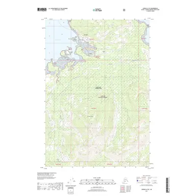
2017 Map of Juneau A-5 SE
USGS Topo · Published 2017About this map
Hoonah sits at the northern edge of Chichagof Island, oriented toward the waters of Port Frederick. This portion of the Tongass National Forest showcases a landscape defined by timber and coastal transport, with the Whitestone Logging Camp located south of the main settlement. The geography is punctuated by numerous maritime landmarks, including Grave Point, Harbor Point, and Pitt Island, which together form the approach to the town's harbor. Inland, the map reveals the logistical infrastructure of the region, from the Hoonah Airport to specialized routes like Hoonah Gypsum and Game Creek. This survey captures the spatial relationship between the Tlingit community and the surrounding wilderness, where drainages like Gartina Cr cut through the dense forest toward the shoreline.
Find a feature on this map
27 named features on this map. Tap any name to fly to it.
Don’t see what you’re looking for? This feature index may not catch every label — zoom into the map to look around manually.
Map Details
Editions of this 2017 Juneau A-5 SE Map
This is the sole edition of this map. No revisions or reprints were ever made.
Other maps of this area

1948 · Juneau A-4
USGS Topo · 1:63,360

1948 · Sitka D-5
USGS Topo · 1:63,360

1948 · Sitka D-4
USGS Topo · 1:63,360

1951 · Juneau
USGS Topo · 1:250,000

1951 · Juneau A-5
USGS Topo · 1:63,360

1951 · Sitka
USGS Topo · 1:250,000

1951 · Sitka D-5
USGS Topo · 1:63,360

1952 · Sitka
USGS Topo · 1:250,000

1955 · Sitka D-4
USGS Topo · 1:63,360

1962 · Juneau
USGS Topo · 1:250,000
Featured Places
- Hoonah, AK
- Whitestone Logging Camp (Abandoned), AK
- Whitestone Logging Camp, AK
- Unorganized Borough, AK
- United States