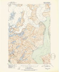
1952 Map of Juneau B-1
USGS Topo · Published 1953About this map
Glacial ice and industrial infrastructure dominate this mid-century survey of the terrain east of Juneau. Massive ice flows, including the Taku Glacier and Norris Glacier, converge toward Taku Inlet, while Hole-in-the-Wall Glacier carves through the northern peaks. The map documents the complex landscape of the Tongass National Forest, showing how the early 20th-century mining and power economy integrated with the environment.
Find a feature on this map
43 named features on this map. Tap any name to fly to it.
Don’t see what you’re looking for? This feature index may not catch every label — zoom into the map to look around manually.
Map Details
Editions of this 1952 Juneau B-1 Map
3 editions found
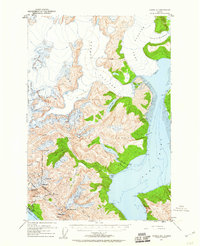
Other maps of this area

1947 · Juneau B-2
USGS Topo · 1:63,360

1948 · Juneau B-1
USGS Topo · 1:63,360

1949 · Juneau B-2
USGS Topo · 1:62,500

1951 · Juneau
USGS Topo · 1:250,000

1951 · Taku River B-6
USGS Topo · 1:63,360

1951 · Taku River A-6
USGS Topo · 1:63,360

1951 · Juneau A-2
USGS Topo · 1:63,360

1951 · Juneau A-1
USGS Topo · 1:63,360

1952 · Juneau B-1
USGS Topo · 1:63,360

1953 · Taku River
USGS Topo · 1:250,000