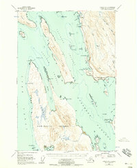
1947 Map of Juneau B-3
USGS Topo · Published 1958About this map
The Glacier Highway skirts the coastline of mainland Alaska, connecting small settlements like Dotsons Landing and St Terese to the growing environs of Juneau. This 1947 survey captures a critical marine crossroads where Saginaw Channel, Favorite Channel, and Lynn Canal converge around the significant landmasses of Shelter Island and the northern tip of Admiralty Island. The map details the transition from maritime infrastructure, such as the Lighthouse at Point Retreat, to early recreational and industrial sites like the Auke Village Recreation Area, a Powerhouse, and a Radio Tower.
Find a feature on this map
95 named features on this map. Tap any name to fly to it.
Don’t see what you’re looking for? This feature index may not catch every label — zoom into the map to look around manually.
Map Details
Editions of this 1947 Juneau B-3 Map
2 editions found
Other maps of this area

1947 · Juneau B-3
USGS Topo · 1:63,360

1947 · Juneau B-2
USGS Topo · 1:63,360

1948 · Juneau B-4
USGS Topo · 1:63,360

1948 · Juneau A-3
USGS Topo · 1:63,360

1948 · Juneau C-4
USGS Topo · 1:63,360

1948 · Juneau A-4
USGS Topo · 1:63,360

1949 · Juneau B-3
USGS Topo · 1:62,500

1949 · Juneau B-2
USGS Topo · 1:62,500

1949 · Juneau C-4
USGS Topo · 1:63,360

1949 · Juneau B-4
USGS Topo · 1:63,360