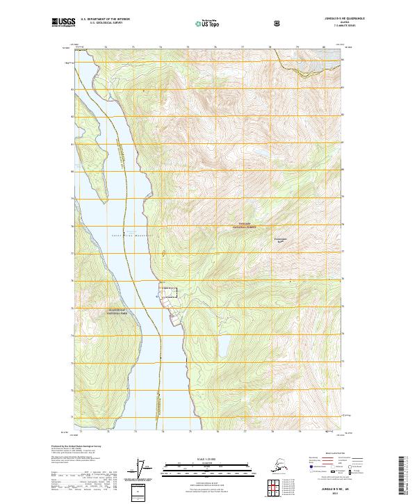
2021 Map of Juneau B-5 NE
USGS Topo · Published 2021About this map
Excursion Inlet serves as the central geographic focal point of this coastal wilderness, where the steep terrain of the Saint Elias Mountains meets the waters of the Sawmill Bay. This modern topographical study documents the administrative convergence of the Haines Borough Hoonah-Angoon Census Area, highlighting a region defined by federal protection. The map illustrates the boundary between Glacier Bay National Park to the west and the Tongass National Forest to the east, capturing the complex maritime interface of the Alaskan panhandle. The relative absence of developed infrastructure outside of the eponymous Excursion Inlet settlement emphasizes the enduringly wild nature of this maritime landscape, where transportation is dictated by the deep glacial fjords rather than a terrestrial road network.
Find a feature on this map
12 named features on this map. Tap any name to fly to it.
Don’t see what you’re looking for? This feature index may not catch every label — zoom into the map to look around manually.
Map Details
Editions of this 2021 Juneau B-5 NE Map
This is the sole edition of this map. No revisions or reprints were ever made.
Other maps of this area

1948 · Juneau C-5
USGS Topo · 1:63,360

1948 · Juneau B-4
USGS Topo · 1:63,360

1948 · Juneau C-4
USGS Topo · 1:63,360

1948 · Juneau B-5
USGS Topo · 1:63,360

1949 · Juneau C-4
USGS Topo · 1:63,360

1949 · Juneau B-4
USGS Topo · 1:63,360

1950 · Juneau B-5
USGS Topo · 1:63,360

1951 · Juneau
USGS Topo · 1:250,000

1962 · Juneau
USGS Topo · 1:250,000
1996 · Juneau B-4
USGS Topo · 1:63,360