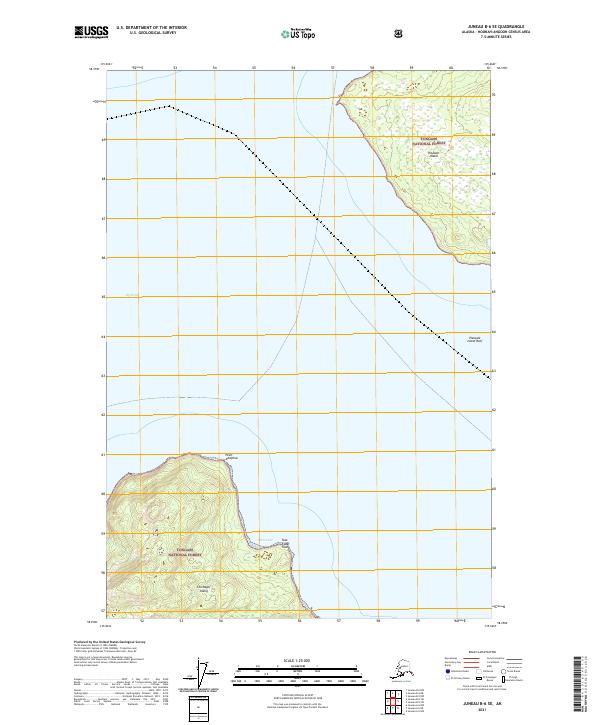
2021 Map of Juneau B-6 SE
USGS Topo · Published 2021About this map
Icy Strait defines this maritime landscape, separating the northern shores of Chichagof Island from the southern coast of Pleasant Island. Both landmasses are part of the Tongass National Forest, illustrating a wilderness largely devoid of modern development or permanent road networks. The northern tip of Chichagof Island is dominated by the prominent landform of Point Adolphus, a significant geographic marker for those navigating the strait. To the east, the map details the protective inlet of Pinta Cove and the nearby Tsaag Xáat'áak. The presence of the Pleasant Island Reef underscores the navigational hazards inherent in these northern Alaskan waters, where the transition from deep water to shore is marked by complex marine features.
Find a feature on this map
14 named features on this map. Tap any name to fly to it.
Don’t see what you’re looking for? This feature index may not catch every label — zoom into the map to look around manually.
Map Details
Editions of this 2021 Juneau B-6 SE Map
This is the sole edition of this map. No revisions or reprints were ever made.
Other maps of this area

1948 · Juneau B-6
USGS Topo · 1:63,360

1948 · Juneau B-5
USGS Topo · 1:63,360

1950 · Juneau B-5
USGS Topo · 1:63,360

1951 · Juneau
USGS Topo · 1:250,000

1951 · Juneau A-6
USGS Topo · 1:63,360

1951 · Juneau A-5
USGS Topo · 1:63,360

1962 · Juneau
USGS Topo · 1:250,000
1994 · Juneau A-5
USGS Topo · 1:63,360
2000 · Juneau A-6
USGS Topo · 1:63,360
2015 · Juneau B-5 NW
USGS Topo · 1:25,000