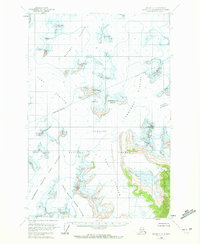
1960 Map of Juneau C-1
USGS Topo · Published 1972About this map
Taku Glacier and the Matthes Glacier dominate this 1960s-era topographical study, revealing the immense scale of the Juneau Icefield. This landscape within the Tongass National Forest is defined by high alpine features such as the Hades Highway and the dramatic rock formations known as the Organ Pipes. The map provides a detailed view of the glaciology of the period, noting numerous crevasses and the converging ice flows of the North Branch Norris Glacier.
Find a feature on this map
28 named features on this map. Tap any name to fly to it.
Don’t see what you’re looking for? This feature index may not catch every label — zoom into the map to look around manually.
Map Details
Editions of this 1960 Juneau C-1 Map
2 editions found

Other maps of this area

1947 · Juneau B-2
USGS Topo · 1:63,360

1948 · Juneau B-1
USGS Topo · 1:63,360

1949 · Juneau B-2
USGS Topo · 1:62,500

1951 · Juneau
USGS Topo · 1:250,000

1951 · Taku River B-6
USGS Topo · 1:63,360

1952 · Juneau B-1
USGS Topo · 1:63,360

1953 · Taku River
USGS Topo · 1:250,000

1960 · Taku River C-6
USGS Topo · 1:63,360

1960 · Juneau D-1
USGS Topo · 1:63,360

1960 · Juneau C-2
USGS Topo · 1:63,360