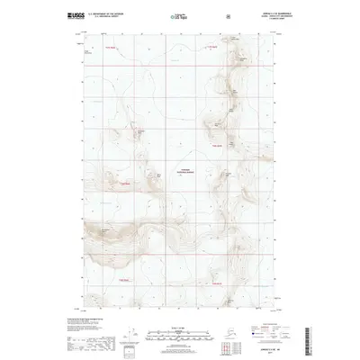
2017 Map of Juneau C-2 SE
USGS Topo · Published 2017About this map
The Coast Mountains of Southeast Alaska dominate this high-elevation landscape, where an immense system of ice fields and dramatic summits defines the interior of Tongass National Forest. Large-scale glacial movement is evident across the sheet, particularly in the convergence of the Taku Glacier and its South Branch Taku Glacier, while the Herbert Glacier and Mendenhall Glacier carve deep paths through the western terrain. Several distinct peaks provide surveying landmarks, ranging from the Little Matterhorn and Cathedral Peak in the north to Amherst Peak in the south.
Find a feature on this map
24 named features on this map. Tap any name to fly to it.
Don’t see what you’re looking for? This feature index may not catch every label — zoom into the map to look around manually.
Map Details
Editions of this 2017 Juneau C-2 SE Map
This is the sole edition of this map. No revisions or reprints were ever made.
Other maps of this area

1947 · Juneau B-2
USGS Topo · 1:63,360

1948 · Juneau B-1
USGS Topo · 1:63,360

1949 · Juneau B-2
USGS Topo · 1:62,500

1951 · Juneau
USGS Topo · 1:250,000

1952 · Juneau B-1
USGS Topo · 1:63,360

1960 · Juneau C-2
USGS Topo · 1:63,360

1960 · Juneau C-1
USGS Topo · 1:63,360

1962 · Juneau B-2
USGS Topo · 1:63,360

1962 · Juneau
USGS Topo · 1:250,000
1986 · Juneau B-2 NW
USGS Topo · 1:25,000