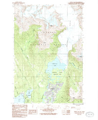
1986 Map of Juneau B-2 NW
USGS Topo · Published 1987About this map
Mendenhaven serves as a primary residential cluster in this mid-1980s Alaskan survey, situated just south of the glacial meltwater systems. The landscape is dominated by the Mendenhall Glacier Recreation Area, where the massive Mendenhall Glacier terminates into Mendenhall Lake. This environment reveals a complex network of active waterways, including Jordan Creek, Duck Creek, and the Mendenhall River, which drain the glacial basin toward Auke Bay.
Find a feature on this map
28 named features on this map. Tap any name to fly to it.
Don’t see what you’re looking for? This feature index may not catch every label — zoom into the map to look around manually.
Map Details
Editions of this 1986 Juneau B-2 NW Map
2 editions found
Other maps of this area

1947 · Juneau B-3
USGS Topo · 1:63,360

1947 · Juneau B-2
USGS Topo · 1:63,360

1949 · Juneau B-3
USGS Topo · 1:62,500

1949 · Juneau B-2
USGS Topo · 1:62,500

1951 · Juneau
USGS Topo · 1:250,000

1951 · Juneau C-3
USGS Topo · 1:63,360

1952 · Juneau C-3
USGS Topo · 1:63,360

1960 · Juneau C-2
USGS Topo · 1:63,360

1962 · Juneau B-2
USGS Topo · 1:63,360

1962 · Juneau B-3
USGS Topo · 1:63,360