
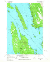
1962 Map of Juneau B-3
USGS Topo · Published 1963About this map
Lincoln Island and Shelter Island dominate the northern waters of this 1962 Alaskan coastal survey, where the rugged maritime geography of the Tongass National Forest meets the intricate inlets of the Inside Passage. Along the mainland coast, the Shrine of St Terese and the settlement at Dotsons Landing provide evidence of early coastal habitation and spiritual life, while the Montana Creek Trail suggests the early routes used for accessing the mountainous interior.
Find a feature on this map
93 named features on this map. Tap any name to fly to it.
Don’t see what you’re looking for? This feature index may not catch every label — zoom into the map to look around manually.
Map Details
Editions of this 1962 Juneau B-3 Map
2 editions found
Other maps of this area

1947 · Juneau B-3
USGS Topo · 1:63,360

1947 · Juneau B-2
USGS Topo · 1:63,360

1948 · Juneau B-4
USGS Topo · 1:63,360

1948 · Juneau A-3
USGS Topo · 1:63,360

1948 · Juneau C-4
USGS Topo · 1:63,360

1948 · Juneau A-4
USGS Topo · 1:63,360

1949 · Juneau B-3
USGS Topo · 1:62,500

1949 · Juneau B-2
USGS Topo · 1:62,500

1949 · Juneau C-4
USGS Topo · 1:63,360

1949 · Juneau B-4
USGS Topo · 1:63,360