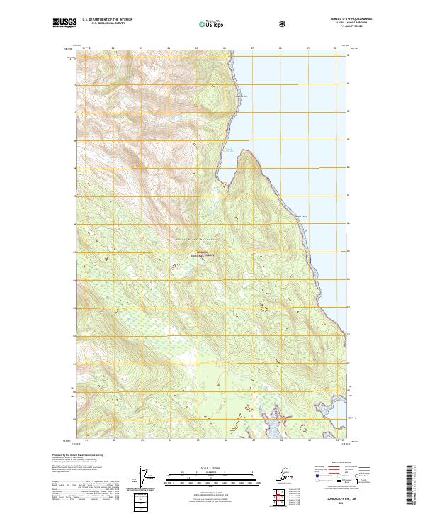
2021 Map of Juneau C-4 NW
USGS Topo · Published 2021About this map
Tongass National Forest covers the majority of this coastal Alaskan landscape, where the slopes of the Saint Elias Mountains meet the waters of Lynn Canal. This map illustrates a transition from the high peaks of the interior down to the shoreline, marked by steep elevation changes and drainage basins like the one formed by William Henry Cr. The coastal topography is defined by prominent landmarks such as Lance Point and Danger Point, which frame the protected waters of William Henry Bay. Further south, the Beardslee River reaches the coast, cutting through the dense forest. The absence of roads or permanent settlements highlights the wilderness character of the Haines Borough region, where geographic features serve as the primary navigational markers for the maritime and mountaineering activities common to this part of Southeast Alaska.
Find a feature on this map
11 named features on this map. Tap any name to fly to it.
Don’t see what you’re looking for? This feature index may not catch every label — zoom into the map to look around manually.
Map Details
Editions of this 2021 Juneau C-4 NW Map
This is the sole edition of this map. No revisions or reprints were ever made.
Other maps of this area

1948 · Juneau C-5
USGS Topo · 1:63,360

1948 · Juneau C-4
USGS Topo · 1:63,360

1949 · Juneau D-5
USGS Topo · 1:63,360

1949 · Juneau D-4
USGS Topo · 1:63,360

1949 · Juneau C-4
USGS Topo · 1:63,360

1951 · Juneau
USGS Topo · 1:250,000

1951 · Juneau D-4
USGS Topo · 1:63,360

1962 · Juneau
USGS Topo · 1:250,000
1996 · Juneau C-4
USGS Topo · 1:63,360
1996 · Juneau D-5
USGS Topo · 1:63,360