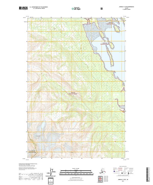
2021 Map of Juneau C-4 SW
USGS Topo · Published 2021About this map
Saint James Bay defines the eastern shoreline of this coastal Alaskan landscape, where the tides meet the dense timber of the Tongass National Forest. The terrain transitions sharply from the waterfront at Saint James Point to the high elevations of the Chilkat Range and the Saint Elias Mountains. This topographic survey shows a largely roadless wilderness at the boundary of the Haines Borough and the Hoonah-Angoon Census Area, highlighting the remote character of the region. To the southwest, the protected lands of Glacier Bay National Park reach toward Nur Mtn, illustrating the conservation of this glacial environment. The maritime geography is further detailed by features like Lynn Brothers, serving as a record of the inlets and points that navigate the Inside Passage.
Find a feature on this map
16 named features on this map. Tap any name to fly to it.
Don’t see what you’re looking for? This feature index may not catch every label — zoom into the map to look around manually.
Map Details
Editions of this 2021 Juneau C-4 SW Map
This is the sole edition of this map. No revisions or reprints were ever made.
Other maps of this area

1948 · Juneau C-5
USGS Topo · 1:63,360

1948 · Juneau B-4
USGS Topo · 1:63,360

1948 · Juneau C-4
USGS Topo · 1:63,360

1948 · Juneau B-5
USGS Topo · 1:63,360

1949 · Juneau C-4
USGS Topo · 1:63,360

1949 · Juneau B-4
USGS Topo · 1:63,360

1950 · Juneau B-5
USGS Topo · 1:63,360

1951 · Juneau
USGS Topo · 1:250,000

1962 · Juneau
USGS Topo · 1:250,000
1996 · Juneau B-4
USGS Topo · 1:63,360