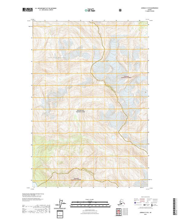
2021 Map of Juneau C-5 SE
USGS Topo · Published 2021About this map
The Saint Elias Mountains define this high-altitude landscape where the administrative boundaries of the Haines Borough Hoonah-Angoon Census Area divide the wilderness. This survey captures a transition between massive federal protected lands, showing the interior reaches of Glacier Bay National Park and the sprawling Tongass National Forest. The map is dominated by extreme relief and complex ice-and-rock terrain typical of the Alaskan panhandle. Lacking any modern roads or permanent settlements, the area is instead structured by the Public Land Survey System, with township and range lines like t38s r61e providing the only reference points across the vast mountain ridges. The geography here is a study in raw wilderness preservation and the intersection of large-scale environmental management zones in the early twenty-first century.
Find a feature on this map
10 named features on this map. Tap any name to fly to it.
Don’t see what you’re looking for? This feature index may not catch every label — zoom into the map to look around manually.
Map Details
Editions of this 2021 Juneau C-5 SE Map
This is the sole edition of this map. No revisions or reprints were ever made.
Other maps of this area

1948 · Juneau C-5
USGS Topo · 1:63,360

1948 · Juneau B-4
USGS Topo · 1:63,360

1948 · Juneau C-4
USGS Topo · 1:63,360

1948 · Juneau B-5
USGS Topo · 1:63,360

1949 · Juneau C-4
USGS Topo · 1:63,360

1949 · Juneau B-4
USGS Topo · 1:63,360

1950 · Juneau B-5
USGS Topo · 1:63,360

1951 · Juneau
USGS Topo · 1:250,000

1962 · Juneau
USGS Topo · 1:250,000
1996 · Juneau B-4
USGS Topo · 1:63,360