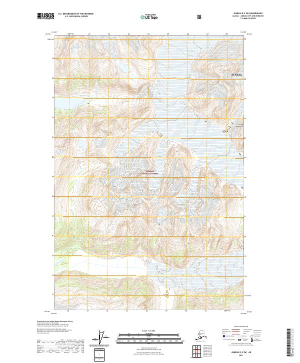
2021 Map of Juneau D-2 SW
USGS Topo · Published 2021About this map
The Coast Mountains dominate this glacial landscape within the Tongass National Forest north of the Juneau city and borough. This is a region defined by high alpine elevations and the movement of water, where the Antler River cuts through steep contours in the northern reaches while the Gilkey River flows through the southern valley floor. The map illustrates a wilderness at the height of modern surveying, documenting the intricate drainage patterns and ice-carved topography that characterize this portion of the Alaska panhandle. For those studying the remote geography of the Pacific Northwest, these terrain features provide a clear picture of the natural boundaries that separate the river valleys from the towering peaks along the Canadian border.
Find a feature on this map
11 named features on this map. Tap any name to fly to it.
Don’t see what you’re looking for? This feature index may not catch every label — zoom into the map to look around manually.
Map Details
Editions of this 2021 Juneau D-2 SW Map
This is the sole edition of this map. No revisions or reprints were ever made.
Other maps of this area

1948 · Juneau D-3
USGS Topo · 1:63,360

1949 · Juneau D-3
USGS Topo · 1:63,360

1951 · Juneau
USGS Topo · 1:250,000

1951 · Juneau C-3
USGS Topo · 1:63,360

1952 · Juneau C-3
USGS Topo · 1:63,360

1953 · Juneau D-3
USGS Topo · 1:63,360

1960 · Juneau C-2
USGS Topo · 1:63,360

1960 · Juneau D-2
USGS Topo · 1:63,360

1962 · Juneau
USGS Topo · 1:250,000
1996 · Juneau C-3
USGS Topo · 1:63,360