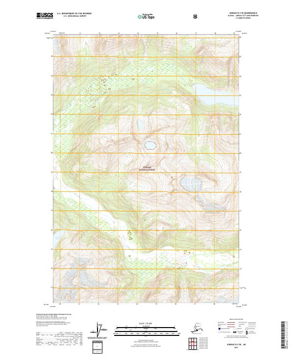
2021 Map of Juneau D-3 SE
USGS Topo · Published 2021About this map
Tongass National Forest dominates this Alaskan landscape, where the glacial drainage systems of the Antler River and Gilkey River carve through high-elevation terrain. This 2021 topographic record of the Juneau D-3 SE area illustrates the complex hydrology of the region, featuring the transition from alpine catchments to the larger river valleys. The northern portion of the map is defined by the upper reaches of the Antler River, which flows into the basin containing Antler Lake. To the south, the Gilkey River cuts across the survey area, showing the braided water patterns common to this part of the Alaska Panhandle. This map serves as a primary reference for the exact boundaries of the National Forest across Townships 34 through 36 South, providing essential detail for researchers studying the hydrography and land management of the Juneau City and Borough.
Find a feature on this map
10 named features on this map. Tap any name to fly to it.
Don’t see what you’re looking for? This feature index may not catch every label — zoom into the map to look around manually.
Map Details
Editions of this 2021 Juneau D-3 SE Map
This is the sole edition of this map. No revisions or reprints were ever made.
Other maps of this area

1948 · Juneau D-3
USGS Topo · 1:63,360

1949 · Juneau D-3
USGS Topo · 1:63,360

1951 · Juneau
USGS Topo · 1:250,000

1951 · Juneau C-3
USGS Topo · 1:63,360

1952 · Juneau C-3
USGS Topo · 1:63,360

1953 · Juneau D-3
USGS Topo · 1:63,360

1960 · Juneau C-2
USGS Topo · 1:63,360

1960 · Juneau D-2
USGS Topo · 1:63,360

1962 · Juneau
USGS Topo · 1:250,000
1986 · Juneau C-3 NW
USGS Topo · 1:25,000