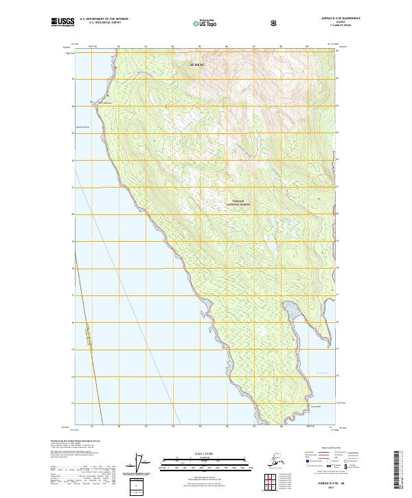
2021 Map of Juneau D-4 SE
USGS Topo · Published 2021About this map
Berners Bay and the northern reaches of Lynn Canal define this coastal landscape, where the Tongass National Forest meets the sea. The area is marked by a history of resource extraction, evidenced by the Kensington Mine Road in the north and the Jualin Mine Road near Johnson Cr. This 2021 survey illustrates the rugged interface between the shore and the steep inland terrain, punctuated by features such as Snowslide Gulch and Point Sherman. Maritime safety and navigation are anchored by landmarks like Sherman Rock and Cove Point, while a network of drainages including Ophir Cr, Sherman Cr, and Sweeny Cr carve through the forested slopes. The map also delineates the boundary between Juneau and Haines Borough.
Find a feature on this map
21 named features on this map. Tap any name to fly to it.
Don’t see what you’re looking for? This feature index may not catch every label — zoom into the map to look around manually.
Map Details
Editions of this 2021 Juneau D-4 SE Map
This is the sole edition of this map. No revisions or reprints were ever made.
Other maps of this area

1948 · Juneau C-4
USGS Topo · 1:63,360

1948 · Juneau D-3
USGS Topo · 1:63,360

1949 · Juneau D-4
USGS Topo · 1:63,360

1949 · Juneau C-4
USGS Topo · 1:63,360

1949 · Juneau D-3
USGS Topo · 1:63,360

1951 · Juneau
USGS Topo · 1:250,000

1951 · Juneau D-4
USGS Topo · 1:63,360

1951 · Juneau C-3
USGS Topo · 1:63,360

1952 · Juneau C-3
USGS Topo · 1:63,360

1953 · Juneau D-3
USGS Topo · 1:63,360