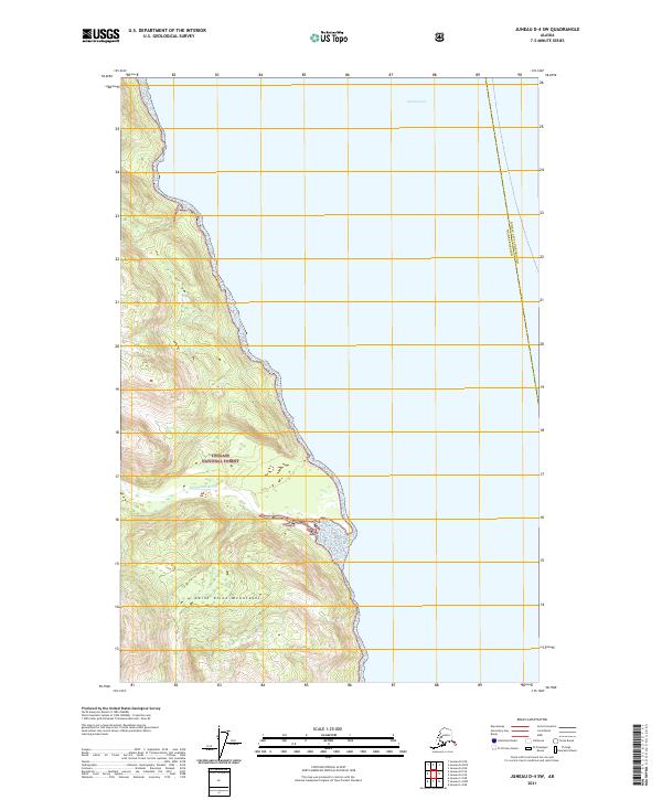
2021 Map of Juneau D-4 SW
USGS Topo · Published 2021About this map
Tongass National Forest dominates the coastal topography of this 2021 survey, where the steep ridgelines of the Saint Elias Mountains meet the waters of southeast Alaska. The landscape is defined by its dramatic elevation changes, with glacial-fed drainage systems such as the Endicott River cutting through the mountainous terrain as they flow toward the sea. The eastern edge of the map is bordered by the expansive waters of the Lynn Canal, a deep-water fjord that serves as a vital marine highway for the region. This document captures the wilderness character of the area, illustrating the intersection of the Juneau City and Borough Haines Borough boundary line. The absence of roads or permanent settlements highlights the protected, natural state of this portion of the Alaskan panhandle, making it an essential reference for understanding the hydrological and geological patterns of the northern coast.
Find a feature on this map
12 named features on this map. Tap any name to fly to it.
Don’t see what you’re looking for? This feature index may not catch every label — zoom into the map to look around manually.
Map Details
Editions of this 2021 Juneau D-4 SW Map
This is the sole edition of this map. No revisions or reprints were ever made.
Other maps of this area

1948 · Juneau C-5
USGS Topo · 1:63,360

1948 · Juneau C-4
USGS Topo · 1:63,360

1949 · Juneau D-5
USGS Topo · 1:63,360

1949 · Juneau D-4
USGS Topo · 1:63,360

1949 · Juneau C-4
USGS Topo · 1:63,360

1951 · Juneau
USGS Topo · 1:250,000

1951 · Juneau D-4
USGS Topo · 1:63,360

1962 · Juneau
USGS Topo · 1:250,000
1996 · Juneau C-4
USGS Topo · 1:63,360
1996 · Juneau D-5
USGS Topo · 1:63,360