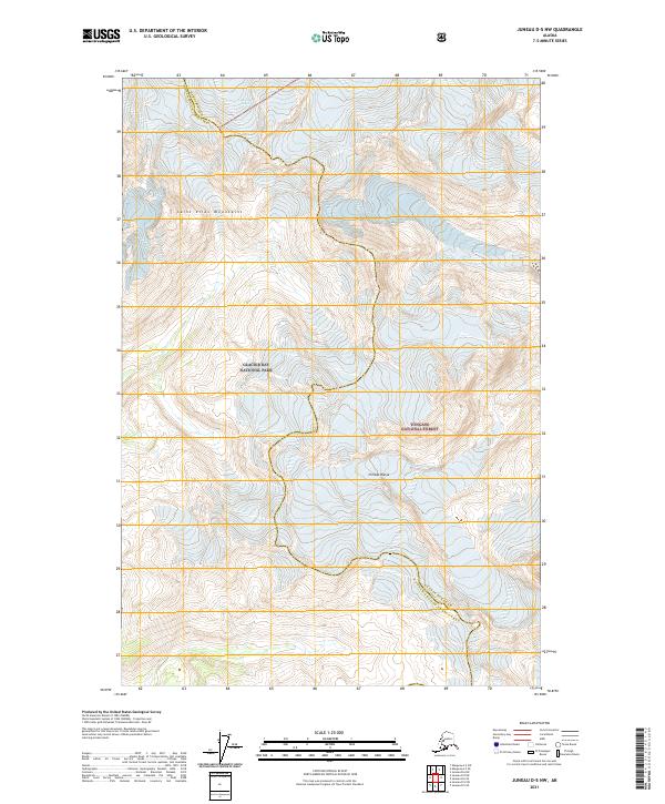
2021 Map of Juneau D-5 NW
USGS Topo · Published 2021About this map
Glacier Bay National Park and the Tongass National Forest converge in this high-altitude wilderness along the boundary between the Haines Borough and Hoonah-Angoon Census Area. The landscape is dominated by the monumental Davidson Glacier and the jagged peaks of the Saint Elias Mountains. This topographic record illustrates the ice-carved drainage patterns and steep elevation changes typical of the Chilkat Range, where meltwater feeds smaller streams such as Berg Cr. The map provides a precise account of the territorial intersections between federal parklands and national forest lands, documenting the undeveloped character of this coastal mountain environment in the early twenty-first century.
Find a feature on this map
11 named features on this map. Tap any name to fly to it.
Don’t see what you’re looking for? This feature index may not catch every label — zoom into the map to look around manually.
Map Details
Editions of this 2021 Juneau D-5 NW Map
This is the sole edition of this map. No revisions or reprints were ever made.
Other maps of this area

1949 · Juneau D-6
USGS Topo · 1:63,360

1949 · Juneau D-5
USGS Topo · 1:63,360

1951 · Juneau
USGS Topo · 1:250,000

1952 · Skagway
USGS Topo · 1:250,000

1954 · Skagway A-2
USGS Topo · 1:63,360

1961 · Skagway
USGS Topo · 1:250,000

1962 · Juneau
USGS Topo · 1:250,000
1996 · Juneau D-5
USGS Topo · 1:63,360
2004 · Skagway A-2
USGS Topo · 1:63,360
2017 · Juneau D-6 NE
USGS Topo · 1:25,000