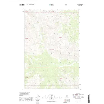
2017 Map of Juneau D-5 SE
USGS Topo · Published 2017About this map
Endicott River flows through this 2017 survey of the Southeast Alaska wilderness, cutting a deep valley across the southwestern portion of the map. The entire landscape is contained within the Tongass National Forest, characterized by high alpine ridges and steep drainage basins typical of the Haines Borough interior. This specific quadrangle captures the raw topography of the Coast Mountains before the river reaches the coastal inlets, showing the intricate system of ridges and glacial valleys that define the regional hydrology. Without settlements or roads, the map focuses on the natural elevation changes and the protected status of the land under the Tongass National Forest designation, providing an essential resource for understanding the drainage patterns and land-management boundaries of this undeveloped corridor.
Find a feature on this map
8 named features on this map. Tap any name to fly to it.
Don’t see what you’re looking for? This feature index may not catch every label — zoom into the map to look around manually.
Map Details
Editions of this 2017 Juneau D-5 SE Map
This is the sole edition of this map. No revisions or reprints were ever made.
Other maps of this area

1948 · Juneau C-5
USGS Topo · 1:63,360

1948 · Juneau C-4
USGS Topo · 1:63,360

1949 · Juneau D-5
USGS Topo · 1:63,360

1949 · Juneau D-4
USGS Topo · 1:63,360

1949 · Juneau C-4
USGS Topo · 1:63,360

1951 · Juneau
USGS Topo · 1:250,000

1951 · Juneau D-4
USGS Topo · 1:63,360

1962 · Juneau
USGS Topo · 1:250,000
1996 · Juneau C-4
USGS Topo · 1:63,360
1996 · Juneau D-5
USGS Topo · 1:63,360