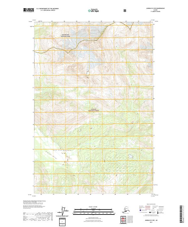
2021 Map of Juneau D-5 SW
USGS Topo · Published 2021About this map
Endicott River carves through this remote wilderness where the boundaries of Glacier Bay National Park and the Tongass National Forest meet. The terrain is defined by the high peaks of the Saint Elias Mountains, including the prominent Mt Young, which overlooks the deep Endicott Valley. This 2021 survey illustrates the intersection of the Haines Borough boundary within a landscape dominated by massive ice-carved drainage systems. The map detail reflects a purely natural environment, providing a technical record of the river's path and the steep contour gradients that characterize this portion of Southeast Alaska's protected lands.
Find a feature on this map
13 named features on this map. Tap any name to fly to it.
Don’t see what you’re looking for? This feature index may not catch every label — zoom into the map to look around manually.
Map Details
Editions of this 2021 Juneau D-5 SW Map
This is the sole edition of this map. No revisions or reprints were ever made.
Other maps of this area

1948 · Juneau C-5
USGS Topo · 1:63,360

1948 · Juneau C-6
USGS Topo · 1:63,360

1949 · Juneau D-6
USGS Topo · 1:63,360

1949 · Juneau D-5
USGS Topo · 1:63,360

1950 · Juneau C-6
USGS Topo · 1:63,360

1951 · Juneau
USGS Topo · 1:250,000

1962 · Juneau
USGS Topo · 1:250,000
1996 · Juneau D-5
USGS Topo · 1:63,360
2017 · Juneau D-6 NE
USGS Topo · 1:25,000
2017 · Juneau D-6 SE
USGS Topo · 1:25,000