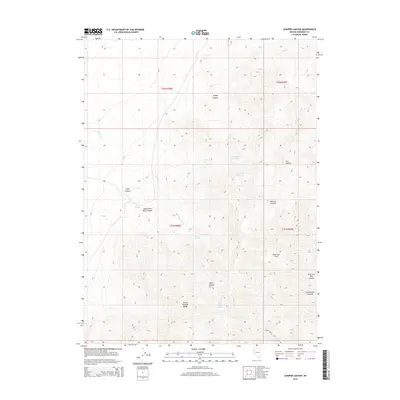
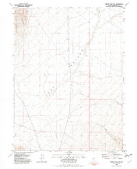
2014 Map of Juniper Canyon
USGS Topo · Published 2014About this map
The Seven Troughs Range dominates this portion of Pershing County, where high-desert drainages and isolated water sources define the character of the terrain. Essential water points such as Alson Spring, Nera Spring, and Burnt Canyon Spring are critical landmarks in an otherwise arid environment. The map details a complex system of canyons including Mule Canyon, Stonehouse Canyon, and Juniper Canyon, which cut through the uplifted landscape. In the southeastern portion, American Flats provides a rare area of level ground before transitioning into the American Flat Canyon. This modern survey by the U.S. Geological Survey reflects a landscape primarily shaped by its hydrology, with seasonal flows like Willow Cr and Cow Cr carving the desert floor between the ridges.
Find a feature on this map
22 named features on this map. Tap any name to fly to it.
Don’t see what you’re looking for? This feature index may not catch every label — zoom into the map to look around manually.
Map Details
Editions of this 2014 Juniper Canyon Map
This is the sole edition of this map. No revisions or reprints were ever made.
Other maps of this area

1931 · Lovelock
USGS Topo · 1:250,000

1935 · Lovelock
USGS Topo · 1:250,000

1955 · Lovelock
USGS Topo · 1:250,000

1959 · Lovelock
USGS Topo · 1:250,000
1981 · Sheep Spring
USGS Topo · 1:24,000
1981 · Dead Horse Canyon
USGS Topo · 1:24,000

1981 · Dead Horse Canyon NE
USGS Topo · 1:24,000
1981 · Seven Troughs
USGS Topo · 1:24,000

1981 · Placerites
USGS Topo · 1:24,000
1981 · Trinity Pass NW
USGS Topo · 1:24,000