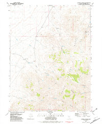
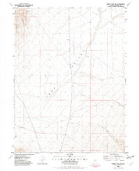
1982 Map of Juniper Canyon
USGS Topo · Published 1982About this map
Miners Cow Creek Ranch and the rugged expanse of the Seven Troughs define this remote high-desert landscape in Pershing County. Recorded in the early 1980s, the map reveals a terrain shaped by mineral extraction and water management, where numerous prospects and a primary mine are scattered across American Flat and Wildcat Canyon. The dependence on intermittent water sources is evident in the naming of specific springs, such as Nera Spring No 56, Nera Spring No 33, and Burnt Canyon Spring, which served as critical points for both ranching and prospecting operations. A network of four-wheel-drive trails connects these sites through steep drainages like Juniper Canyon and Stonehouse Canyon, illustrating the isolation and specialized land use of this Nevada interior. The presence of water tanks and various bench marks, including Seven Troughs, provides a precise record of the human infrastructure developed to support industry in this arid environment.
Find a feature on this map
33 named features on this map. Tap any name to fly to it.
Don’t see what you’re looking for? This feature index may not catch every label — zoom into the map to look around manually.
Map Details
Editions of this 1982 Juniper Canyon Map
This is the sole edition of this map. No revisions or reprints were ever made.
Other maps of this area

1931 · Lovelock
USGS Topo · 1:250,000

1935 · Lovelock
USGS Topo · 1:250,000

1955 · Lovelock
USGS Topo · 1:250,000

1959 · Lovelock
USGS Topo · 1:250,000
1981 · Sheep Spring
USGS Topo · 1:24,000
1981 · Dead Horse Canyon
USGS Topo · 1:24,000

1981 · Dead Horse Canyon NE
USGS Topo · 1:24,000
1981 · Seven Troughs
USGS Topo · 1:24,000

1981 · Placerites
USGS Topo · 1:24,000
1981 · Trinity Pass NW
USGS Topo · 1:24,000