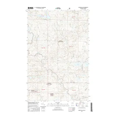
2016 Map of Kabustasa Lake
USGS Topo · Published 2016About this map
The Superior National Forest dominates this northern Minnesota landscape, where the Vermilion River snakes through dense woodlands and complex hydrology. The interior is marked by a network of specialized routes, including Taft Spur AB and Gold Mine Spur, which suggest a history of resource extraction and transit through the timberland. Centrally, Kabustasa Lake and Echo Lake provide significant water features alongside smaller bodies like Daniels Pond. Local family and place names are preserved through roads such as Beitz Road, Norman Road, and Mankys Rd.. For genealogists and local historians, the Forest Home Cem located near Cemetery Rd serves as a primary landmark for family research. The southeastern quadrant is traversed by the Voyageur Snowmobile Trail, reflecting the area's modern integration of recreational use with its established wilderness and township boundaries.
Find a feature on this map
30 named features on this map. Tap any name to fly to it.
Don’t see what you’re looking for? This feature index may not catch every label — zoom into the map to look around manually.
Map Details
Editions of this 2016 Kabustasa Lake Map
This is the sole edition of this map. No revisions or reprints were ever made.
Other maps of this area

1954 · International Falls
USGS Topo · 1:250,000

1957 · International Falls
USGS Topo · 1:250,000

1958 · International Falls
USGS Topo · 1:250,000

1963 · Echo Lake
USGS Topo · 1:24,000

1963 · Picket Lake
USGS Topo · 1:24,000

1963 · Crane Lake
USGS Topo · 1:24,000

1967 · Kabustasa Lake
USGS Topo · 1:24,000

1967 · Marion Lake
USGS Topo · 1:24,000

1967 · Elephant Lake
USGS Topo · 1:24,000
1967 · Buyck
USGS Topo · 1:24,000