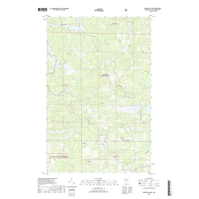
2019 Map of Kabustasa Lake
USGS Topo · Published 2019About this map
The Vermilion River system defines this portion of the Superior National Forest, where water travels through landmarks like Vermilion Falls and Chipmunk Falls. This landscape is shaped by the drainage patterns of Camp Forty Creek and the Pelican River, which feed into the larger river network. The presence of Forest Home Cem along Cemetery Rd provides a specific point of local historical interest within a territory otherwise dominated by timber and recreational lands.
Find a feature on this map
31 named features on this map. Tap any name to fly to it.
Don’t see what you’re looking for? This feature index may not catch every label — zoom into the map to look around manually.
Map Details
Editions of this 2019 Kabustasa Lake Map
This is the sole edition of this map. No revisions or reprints were ever made.
Other maps of this area

1954 · International Falls
USGS Topo · 1:250,000

1957 · International Falls
USGS Topo · 1:250,000

1958 · International Falls
USGS Topo · 1:250,000

1963 · Echo Lake
USGS Topo · 1:24,000

1963 · Picket Lake
USGS Topo · 1:24,000

1963 · Crane Lake
USGS Topo · 1:24,000

1967 · Kabustasa Lake
USGS Topo · 1:24,000

1967 · Marion Lake
USGS Topo · 1:24,000

1967 · Elephant Lake
USGS Topo · 1:24,000
1967 · Buyck
USGS Topo · 1:24,000