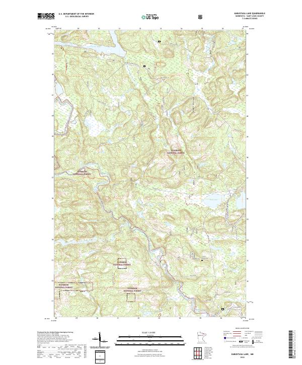
2022 Map of Kabustasa Lake
USGS Topo · Published 2022About this map
Superior National Forest encompasses the entirety of this northern landscape, defined by a complex network of waterways and timber access roads. The Vermilion River snakes through the northern and western reaches, punctuated by Vermilion Falls and Chipmunk Falls. This modern survey reveals a landscape primarily managed for recreation and natural resources, where historical infrastructure like the Gold Mine Spur Trl hints at earlier extractive industries. Human presence is concentrated along corridors such as Cemetery Rd, which leads to the Forest Home Cem, and the recreational hub around Echo Lake. The map provides a detailed look at forest management through named spurs like Taft Spur Aba and Vermigrade Spur Daa Trl, reflecting the area's ongoing role in the regional timber economy while preserving corridors for the Voyageur Snowmobile Trl.
Find a feature on this map
40 named features on this map. Tap any name to fly to it.
Don’t see what you’re looking for? This feature index may not catch every label — zoom into the map to look around manually.
Map Details
Editions of this 2022 Kabustasa Lake Map
This is the sole edition of this map. No revisions or reprints were ever made.
Other maps of this area

1954 · International Falls
USGS Topo · 1:250,000

1957 · International Falls
USGS Topo · 1:250,000

1958 · International Falls
USGS Topo · 1:250,000

1963 · Echo Lake
USGS Topo · 1:24,000

1963 · Picket Lake
USGS Topo · 1:24,000

1963 · Crane Lake
USGS Topo · 1:24,000

1967 · Kabustasa Lake
USGS Topo · 1:24,000

1967 · Marion Lake
USGS Topo · 1:24,000

1967 · Elephant Lake
USGS Topo · 1:24,000
1967 · Buyck
USGS Topo · 1:24,000