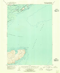
1954 Map of Kaguyak C-6
USGS Topo · Published 1955About this map
Sitkinak Island and the southern tip of the Aiulik Peninsula dominate this mid-century maritime survey of the Trinity Islands archipelago. The landscape is characterized by a network of treacherous waterways, including the Sitkinak Strait and Geese Channel, which separate the rugged landmasses. Human presence is sparse, indicated only by small Cabins tucked away on the Geese Islands, suggesting seasonal use or remote outposts within the coastal wilderness. Much of the northern terrain falls under the protection of the Kodiak National Wildlife Refuge on Kodiak Island. Navigational landmarks such as Cape Sitkinak and False Head provide critical orientation points for vessels navigating the vast Pacific Ocean surrounding these isolated Alaskan landmasses.
Find a feature on this map
16 named features on this map. Tap any name to fly to it.
Don’t see what you’re looking for? This feature index may not catch every label — zoom into the map to look around manually.
Map Details
Editions of this 1954 Kaguyak C-6 Map
2 editions found
Other maps of this area

1951 · Kaguyak
USGS Topo · 1:250,000

1951 · Trinity Islands
USGS Topo · 1:250,000

1952 · Kaguyak
USGS Topo · 1:250,000

1952 · Kaguyak D-5
USGS Topo · 1:63,360

1952 · Trinity Islands D-1
USGS Topo · 1:63,360

1952 · Kaguyak D-6
USGS Topo · 1:63,360

1952 · Trinity Islands C-1
USGS Topo · 1:63,360

1954 · Trinity Islands C-1
USGS Topo · 1:63,360
1954 · Kaguyak D-5
USGS Topo · 1:63,360
1954 · Trinity Islands D-1
USGS Topo · 1:63,360