
1952 Map of Trinity Islands C-1
USGS Topo · Published 1974About this map
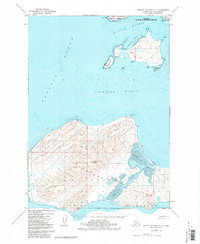
The remote archipelago of the Trinity Islands is documented here as it appeared in the mid-20th century, dominated by the large landmasses of Sitkinak Island and Aiaktalik Island. On the latter, the map notes the site of Aiaktalik (Aban'd), marking a point of human history in this maritime environment. The landscape is defined by its relationship with the Pacific Ocean, characterized by complex coastal features such as Sitkinak Lagoon, Aiaktalik Cove, and the sheltered waters of Russian Harbor.
Find a feature on this map
24 named features on this map. Tap any name to fly to it.
Don’t see what you’re looking for? This feature index may not catch every label — zoom into the map to look around manually.
Map Details
Editions of this 1952 Trinity Islands C-1 Map
2 editions found
Other maps of this area

1951 · Kaguyak
USGS Topo · 1:250,000

1951 · Trinity Islands
USGS Topo · 1:250,000

1952 · Kaguyak
USGS Topo · 1:250,000

1952 · Trinity Islands D-2
USGS Topo · 1:63,360

1952 · Trinity Islands D-1
USGS Topo · 1:63,360

1952 · Kaguyak D-6
USGS Topo · 1:63,360
1952 · Trinity Islands B-2 and C-2
USGS Topo · 1:63,360

1954 · Trinity Islands C-1
USGS Topo · 1:63,360
1954 · Trinity Islands B-2 and C-2
USGS Topo · 1:63,360
1954 · Trinity Islands D-1
USGS Topo · 1:63,360