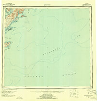
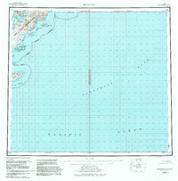
1952 Map of Kaguyak
USGS Topo · Published 1956About this map
The southeastern shoreline of Kodiak Island meets the massive depths of the Albatross Bank in this early 1950s survey. The landscape is defined by the Kodiak National Wildlife Refuge, where the rugged coast is fractured into numerous inlets including Deadman Bay, Portage Bay, and Kaguyak Bay. Near the small settlement of Kaguyak, several Cabin sites are noted, providing a record of human presence in this maritime environment. Further south, the Trinity Islands group, including the large Sitkinak Island with its prominent Cape Sitkinak, sits across the Sitkinak Strait. The map highlights the contrast between the high peaks of the Hepburn Peninsula and the expansive, submarine features of the Pacific Ocean floor, offering essential data for maritime navigation and coastal study in the Territory of Alaska.
Find a feature on this map
36 named features on this map. Tap any name to fly to it.
Don’t see what you’re looking for? This feature index may not catch every label — zoom into the map to look around manually.
Map Details
Editions of this 1952 Kaguyak Map
6 editions found
Other maps of this area

1949 · Kodiak A-3
USGS Topo · 1:63,360

1950 · Kodiak A-3
USGS Topo · 1:63,360

1951 · Kaguyak
USGS Topo · 1:250,000

1951 · Trinity Islands
USGS Topo · 1:250,000

1951 · Karluk
USGS Topo · 1:250,000

1952 · Kodiak
USGS Topo · 1:250,000

1952 · Kaguyak
USGS Topo · 1:250,000

1952 · Karluk
USGS Topo · 1:250,000

1952 · Kaguyak D-5
USGS Topo · 1:63,360

1952 · Trinity Islands D-1
USGS Topo · 1:63,360