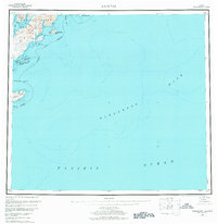
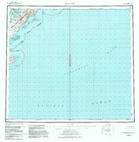
1952 Map of Kaguyak
USGS Topo · Published 1976About this map
The southeastern shoreline of Kodiak Island is defined by a deeply recessed coast of bays and peninsulas, as documented in this mid-century survey. The settlement of Kaguyak sits at the head of Kaguyak Bay, a remote outpost near the southern tip of the Alitak Peninsula. This map illustrates the complex maritime geography of the Kodiak Borough, where sheltered waters like Deadman Bay and Portage Bay provided critical harbor for the region's coastal activities.
Find a feature on this map
33 named features on this map. Tap any name to fly to it.
Don’t see what you’re looking for? This feature index may not catch every label — zoom into the map to look around manually.
Map Details
Editions of this 1952 Kaguyak Map
6 editions found
Other maps of this area

1949 · Kodiak A-3
USGS Topo · 1:63,360

1950 · Kodiak A-3
USGS Topo · 1:63,360

1951 · Kaguyak
USGS Topo · 1:250,000

1951 · Trinity Islands
USGS Topo · 1:250,000

1951 · Karluk
USGS Topo · 1:250,000

1952 · Kodiak
USGS Topo · 1:250,000

1952 · Kaguyak
USGS Topo · 1:250,000

1952 · Karluk
USGS Topo · 1:250,000

1952 · Kaguyak D-5
USGS Topo · 1:63,360

1952 · Trinity Islands D-1
USGS Topo · 1:63,360